[an error occurred while processing this directive]
[an error occurred while processing this directive]
Photos of Louisville - Highland Park #1
What's New? - Another former Highland Park resident is
putting together a web
site on the history of the old neighborhood.
In the late 1980s the City of Louisville purchased up and
later demolished all the homes and businesses in the Highland
Park, Standiford, and Prestonia neighborhoods for airport
expansion.
While Louisville International Airport did get realigned with
twin runways, as of late 2000 only a small portion of the empty
land in Highland Park is being used for airport-related
businesses.
This page is a snapshot of what the area once occupied by the
Highland Park neighborhood now looks like. These photos were
taken on 23 November 2000 near the intersection of Ottawa Avenue
and Park Boulevard in the remains of the Highland Park
neighborhood of Louisville. More photos taken on 26 November 2000
are available on the Highland Park #2
page.
My family lived at a worn old shotgun house on 320 Wawa Avenue
until our house got bought. We since moved to a bigger house in
the Portland neighborhood. My mother doesn't want to see these
photos since she's heartbroken about the whole thing.
Much of the land where houses got bought up and torn down is
currently not being used for anything. It's almost maddening to
think that a bunch of houses were bought out and torn down 5-10
years ago and a majority of the land is not being used for
anything.
In this area you will still see cars drive by occasionally,
and every once in a while you'll see someone (probably homeless)
walking around. Other than taking shortcuts, going to or from a
job, or driving around seeing what the old neighborhood looks
like now, I'm curious as to what these people are doing around
these parts.
To my knowledge this is a list of streets that are still
open:
- The entire length of Park Boulevard. Portions south of Wawa
Avenue are now known as Old Park Boulevard (as indiciated by
one sign) or Tug Road (as indicated by at least two maps I
own). Wawa Avenue east of Park Boulevard is now known as Park
Boulevard. The intersection of Wawa and Park was
realigned.
- Schweirmann Avenue from (formerly) Wawa to Adair
Street.
- Adair Street from Schweirmann to Crittenden Drive.
- Dakota Avenue from Park Boulevard to eastern Louisville
Avenue.
- Most of the eastern Louisville Avenue is open.
- Ottawa Avenue west of Park Boulevard.
- Hiawatha Avenue west of Park Boulevard.
- The Woodlawn Overpass, Nevada Avenue, and Woodlawn
Avenue.
- Wabasso Avenue also remains open, and some businesses in
the area are still there. Other than that, no bulildings
remain.
[an error occurred while processing this directive]
| #036 |
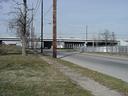
(1024×768 JPG,
234928 bytes)
|
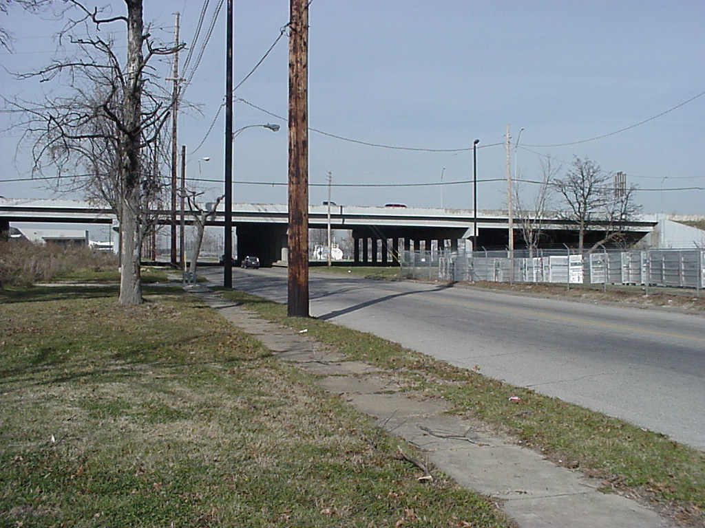
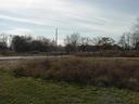
Park Boulevard, now known as ``New Park Boulevard'',
looking north from Ottawa Avenue. I-264 is in the
background. The blockaded street is Southern Heights
Avenue.
|
| #037 |
(1024×768 JPG,
235010 bytes)
|
Park Boulevard looking south towards Ottawa Avenue. The
barracades block what used to be an alley. Highland Park
had a great network of alleys! There used to be a traffic
light at this intersection. I don't know what the blue
artifact in the center of this photo is.
|
| #038 |
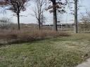
(1024×768 JPG,
333132 bytes)
|
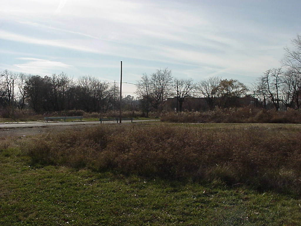
Looking northwest from Park and Ottawa. These trees once
stood in peoples' yards!
|
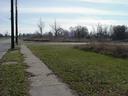
| #039 |
(1024×768 JPG,
197274 bytes)
|
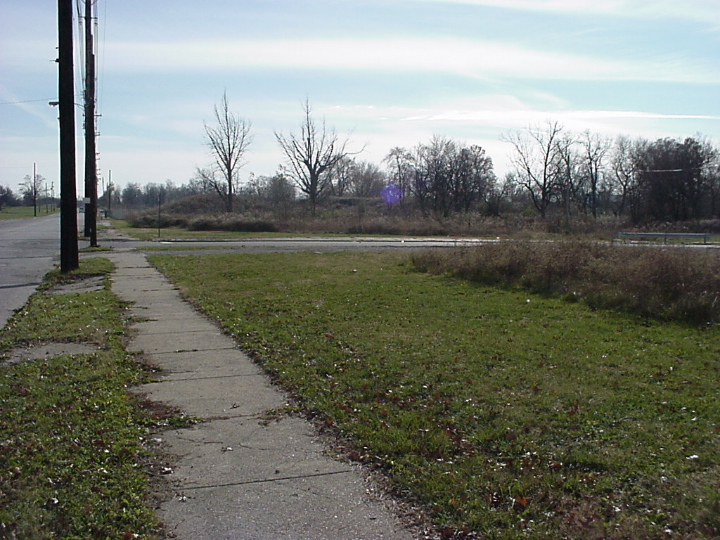
This is Ottawa Avenue west of Park Boulevard. This photo
is looking southwest. A dentist's office, I beileve, used
to stand at the northeast corner of the alley and
Ottawa.
|
| #040 |
(1024×768 JPG,
218899 bytes)
|
Park Boulevard, looking north from Ottawa.
|
| #041 |
(1024×768 JPG,
177194 bytes)
|
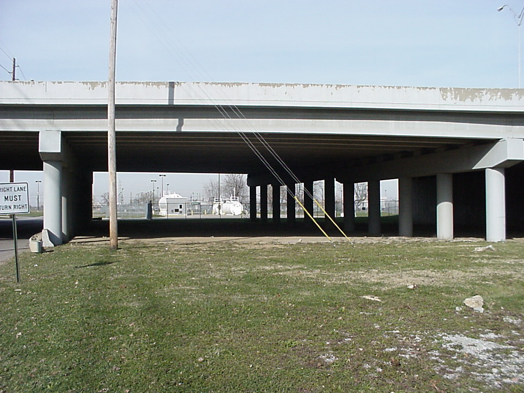
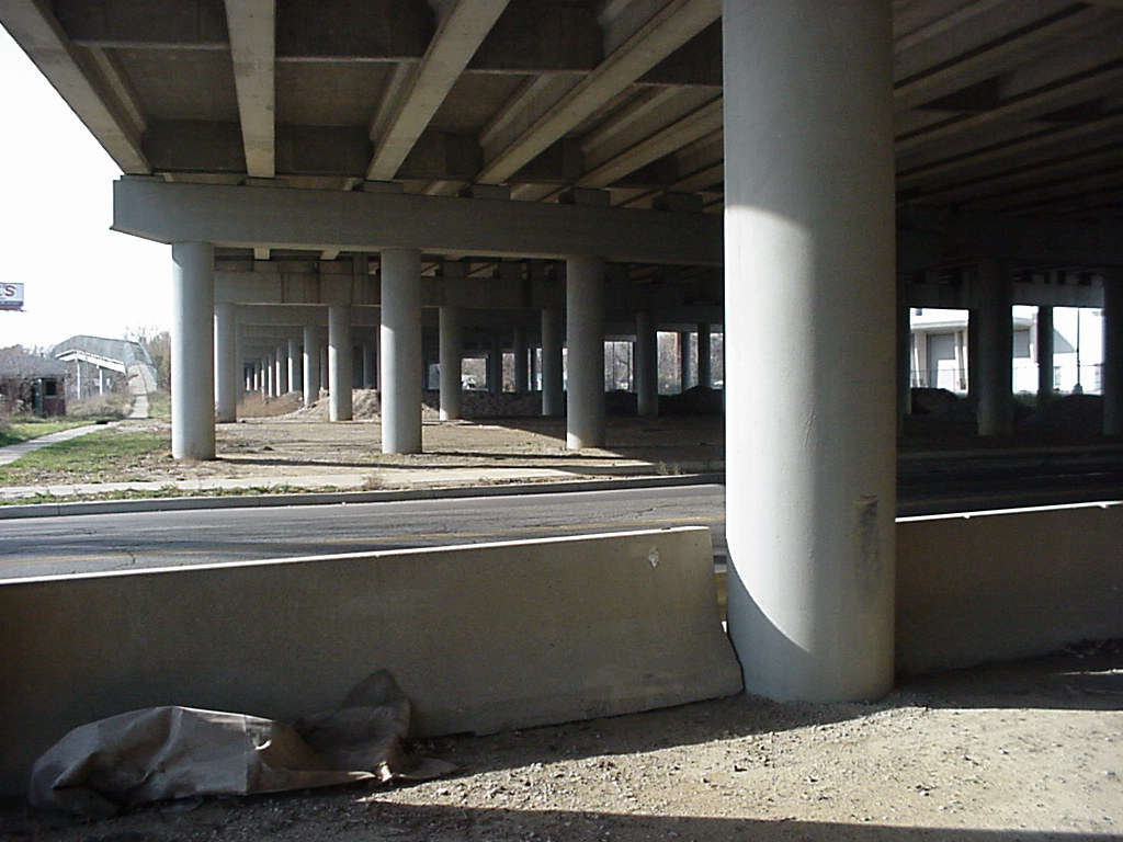
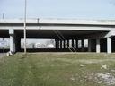
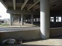
Looking west from under the Watterson Expressway. On the
left you see a pedestrian walkway passing over the CSX
railroad tracks that was built a few years before the
process started to buy out this neighborhood.
|
Related Sites
Another former Highland Park resident is putting together
a web site on the
history of the old neighborhood.
-
A Place in Time: The story of Louisville's neighborhoods
is a book published by the Louisville Courier-Journal
in 1989 featuring profiles of various Louisville
neighborhoods. The contents of the book are online, and
include
a piece on Highland Park.
-
Bryan
Hurst and the Lolligaggers: Not Waiting for Favors is a
Louisville Music News article about ``I Went to Sleep
on Erie'', a song about a woman who lived on Erie Avenue who
woke up one morning finding her street name had changed to
Southern Heights. Unfortunately, the song is not available on
the Bryan Hurst CD.
-
A History of the L&N South Louisville Shops - One of
the major employers of Highland Park residents was the South
Louisville Shops, a repair facility for L&N's railroad
cars. The South Louisville Shops disappeared in the 1980s
when CSX bought the Seaboard System, which purchased L&N
a few years before that. The shops were completely torn down
to make way for the Papa John's Cardinal Stadium and possibly
some other businesses.
-
Bill Allison,
currently on the City of Louisville Board of Aldermen, was
the head of the law firm that represented the neighborhood
associations of Highland Park, Standiford, and Prestonia in
challenging the Regional Airport Authority's use of urban
renewal powers to take the private property in those
neighborhoods for commercial airport-related development. The
Kentucky
Supreme Court declared that the Airport Authority's
actions were illegal and unconstitutionally arbitrary. Peruse
His
biography for more info.
-
Communities, Inc. v.
Busey, 956 F.2d 619 (United States Court of Appeals,
Sixth Circuit, 1992)
-
Louisville
Railway Company streetcar #776 at the Highland Park
Loop
-
TerraServer photos of the current neighborhood. At press
time (30-Nov-2000) the left-hand-side of this view was taken
in 1998, and the right-hand side was taken in 1996.
[an error occurred while processing this directive]